


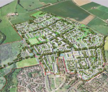
Spatial diagram

A spatial diagram, or spatial plan, can be used to investigate or illustrate the future spatial development of an area. It communicates a development concept as physical spatial elements and demonstrates how extending and developing spatial uses and infrastructure can shape a location, district or region.
The development of spatial diagrams requires imaginative and innovative ideas. Inspiration for developing a spatial diagram is often drawn from the results of other district or regional analysis methods.
A spatial diagram may give indications as to the highest priority areas to be developed, as well as decisions on the settlement pattern for development in the future. Approximate scales are used for the diagram in order to avoid committing to detail. More specific land use plans are developed once a decision has been taken to implement certain elements of a diagram.
A spatial diagram is not constrained by time, but is designed to be a flexible model, capable of providing guidance and information to urban planners and decision-makers in optimising investment. Such investment can encourage and enable economic and social development, and may result in the progressive delivery of the spatial diagram over time.
Investment decisions are often taken, particularly effecting urban centres, with consideration of functional specialisation to avoid too much competition and duplication, which can lead to a decline in markets or services. Spatial diagrams can be used to assist in this planning work, with what is termed a 'settlement pattern'. This indicates issues such as whether or not the economies of the main urban centres are to be further developed or consolidated, whether urban specialisation should be either maintained or encouraged, and so on.
As well as the settlement pattern, information that is often provided on a spatial diagram may include:
- Road networks.
- The land use system.
- Conservation areas.
- Areas where development is to be restricted or controlled.
Some of the benefits of using a spatial diagram include:
- It is a useful method for reviewing proposed development policies and how they may interrelate functionally with ‘space’.
- It provides a framework for guiding an area’s development.
- It can coordinate development activities undertaken by different planning institutions, organisations or departments.
- It can provide guidance to decision-makers and planners about strategic investment decisions.
Some of the limitations of using a spatial diagram include:
- Spatial diagrams do not contain a time line for development.
- The costs and resource mobilisation required are not illustrated, and so, unless previous analytical steps, such as demographic projections and locational evaluations, have been undertaken, the diagram can be misleading.
- There is the risk that spatial diagrams can be interpreted as masterplans, rather than just being used to guide development decisions.
[edit] Related articles on Designing Buildings Wiki
Featured articles and news

The context, schemes, standards, roles and relevance of the Building Safety Act.
Retrofit 25 – What's Stopping Us?

Exhibition Opens at The Building Centre.
Types of work to existing buildings

A simple circular economy wiki breakdown with further links.

A threat to the creativity that makes London special.
How can digital twins boost profitability within construction?

The smart construction dashboard, as-built data and site changes forming an accurate digital twin.
Unlocking surplus public defence land and more to speed up the delivery of housing.
The Planning and Infrastructure Bill
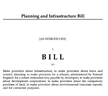
An outline of the bill with a mix of reactions on potential impacts from IHBC, CIEEM, CIC, ACE and EIC.

Farnborough College Unveils its Half-house for Sustainable Construction Training.
Spring Statement 2025 with reactions from industry

Confirming previously announced funding, and welfare changes amid adjusted growth forecast.
Scottish Government responds to Grenfell report

As fund for unsafe cladding assessments is launched.
CLC and BSR process map for HRB approvals
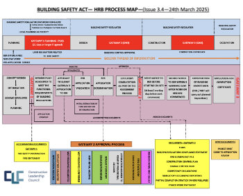
One of the initial outputs of their weekly BSR meetings.
Architects Academy at an insulation manufacturing facility

Programme of technical engagement for aspiring designers.
Building Safety Levy technical consultation response

Details of the planned levy now due in 2026.
Great British Energy install solar on school and NHS sites

200 schools and 200 NHS sites to get solar systems, as first project of the newly formed government initiative.
600 million for 60,000 more skilled construction workers

Announced by Treasury ahead of the Spring Statement.

The restoration of the novelist’s birthplace in Eastwood.
Life Critical Fire Safety External Wall System LCFS EWS

Breaking down what is meant by this now often used term.
PAC report on the Remediation of Dangerous Cladding

Recommendations on workforce, transparency, support, insurance, funding, fraud and mismanagement.
New towns, expanded settlements and housing delivery

Modular inquiry asks if new towns and expanded settlements are an effective means of delivering housing.